| GENERAL |
|
A Survey
of Coal-handling
Facilities on
the Morris Canal - 1999
Detailed
maps of the canal route and facilities begin on page
45. Includes a brief history and
description of the canal.
|
|
Line
of the Morris Canal, New Jersey, 1827
|
|
Morris Canal Map
|
|
Morris Canal map - 1827
|
|
Morris Canal maps
|
|
Morris Canal maps – Canal
Society of New Jersey
Maps begin on page
7 of the search.
|
|
New York Public Library
Digital Collection 
|
|
Path of the Morris Canal
|
|
Morris County – 1887
|
WARREN COUNTY
|
|
Warren County – 1852
|
|
Warren County – 1860
|
|
Warren County – 1872
|
|
Warren County – 1874
|
|
Lopatcong and Greenwich
Townships – 1874
|
|
Phillipsburg, Warren County,
New Jersey: Sanborn Insurance Maps
A
set of maps ranging from 1885 to 1916, showing the
canal route.
|
|
Phillipsburg 1 – 1874
|
|
Phillipsburg 2 – 1874
|
|
Phillipsburg – 1923
|
| Pohatcong
Township Note: this township split off from
Greenwich Township in 1881. The canal passed
through a portion of this township. |
| Greenwich
Township: see map above |
| Franklin
Township: |
|
Franklin Township – 1874
|
|
Franklin Township: New Village
– 1874
|
| Washington
Township: |
|
Washington Township & Port
Colden – 1874
|
| Washington
Borough (surrounded by Washington Township) |
| Washington |
|
Washington Township:
Washington 1 – 1874
|
|
Washington Township:
Washington – 1897
The
canal appears in Images 2 and 9.
|
|
Washington Township:
Washington – 1914
The
canal appears in Images 3, 5 & 8.
|
| Port
Colden: see map above |
| Mansfield
(Rockport, Port Murray) Township: |
|
Mansfield Township – 1874
|
|
Mansfield Township: Port
Murray and Rockport – 1874
|
| Independence
Township: |
|
Independence Township – 1874
|
| Hackettstown |
|
Independence Township:
Hackettstown – 1852
|
|
Independence Township:
Hackettstown – 1874
|
|
Hackettstown Bird’s Eye View –
1883
|
|
Independence Township:
Hackettstown – 1899-1926
|
| Allamuchy
Township: |
|
Allamuchy Township – 1874
|
|
| SUSSEX COUNTY |
|
Sussex County – 1860
|
|
Sussex County – 1872
|
|
Sussex and Warren Counties –
1873
|
| Byram
Township |
| Stanhope
Borough |
| Stanhope |
|
Sussex County, Stanhope:
Sanborn Fire Insurance Maps
A
collection of maps spanning the years 1886 through
1920.
|
| MORRIS COUNTY |
|
Morris County – 1853
|
|
Morris County – 1868
|
|
Morris County – 1872
|
|
Morris, Passaic and Bergen
Counties – 1873
|
|
Morris County – 1887
|
|
Morris County – 1896
|
| Mount Olive Township: |
|
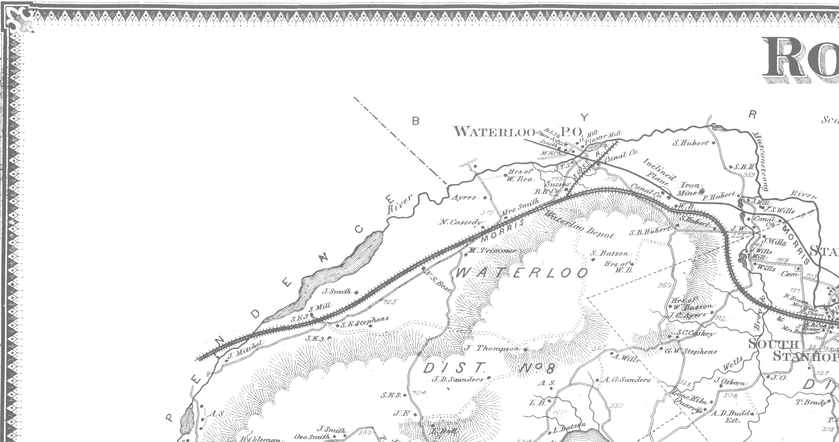
Mount Olive Township,
Flanders, Port Morris P.O., Allentown, South Stanhope
– 1887
|
| Waterloo |
| Stanhope |
| Netcong Borough |
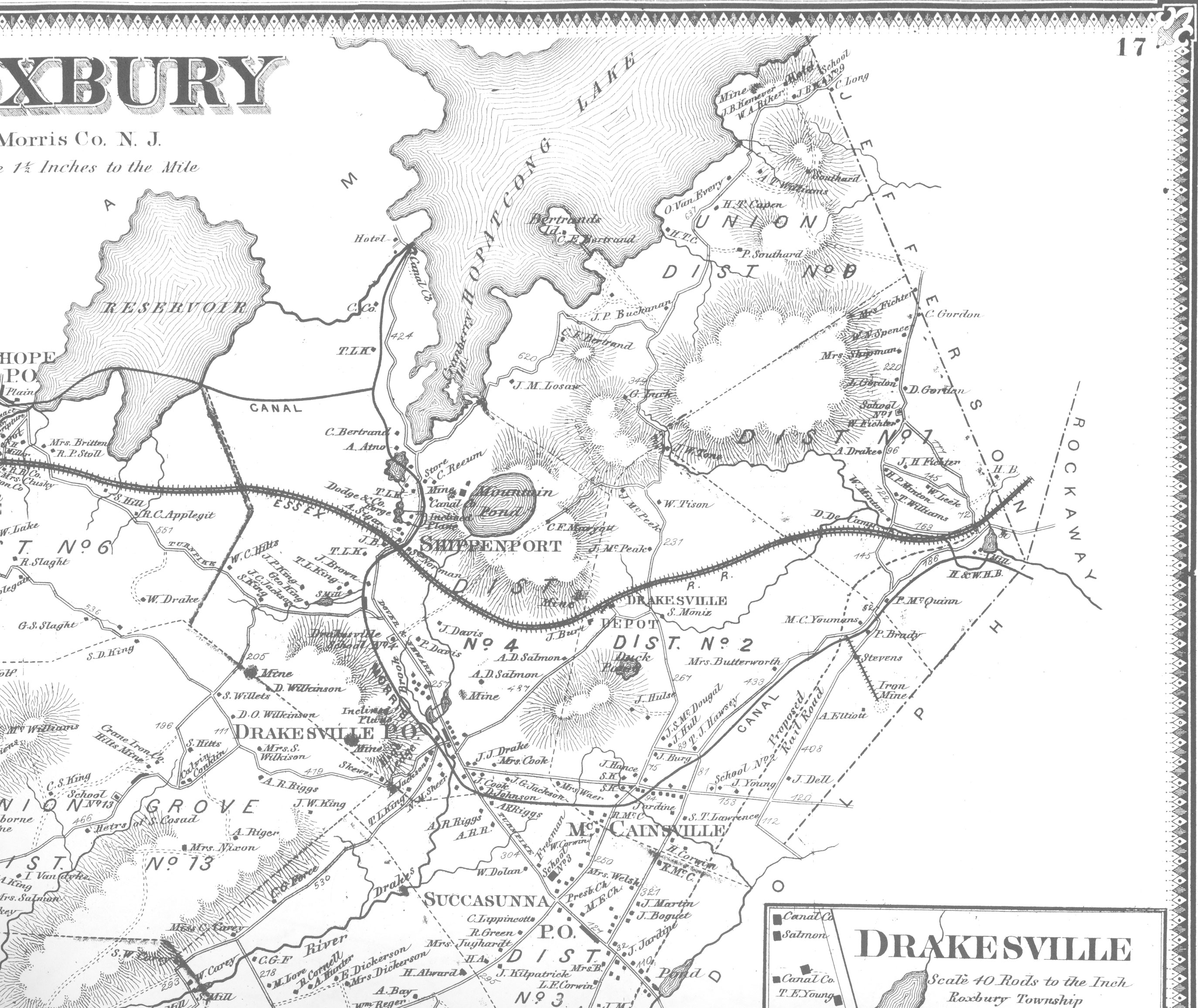
| Roxbury Township: |
| Allentown |
|
Roxbury Township: Roxbury 1 –
1868
|
|
Roxbury Township: Roxbury 3 –
1868
|
| Port Morris |
|
Roxbury Township: Lake
Hopatcong – 1887
|
|
Roxbury Township: Lake
Hopatcong – 1890
|
|
Sanborn Fire Insurance Map
from Lake Hopatcong, Morris And Sussex Counties, New
Jersey – 1917
Views of the canal are on Images 1, 2
and 3.
|
| Shippenport |
Roxbury Township, Suckasunny
P.O., McCainsville P.O., Drakesville P.O. – 1887
|
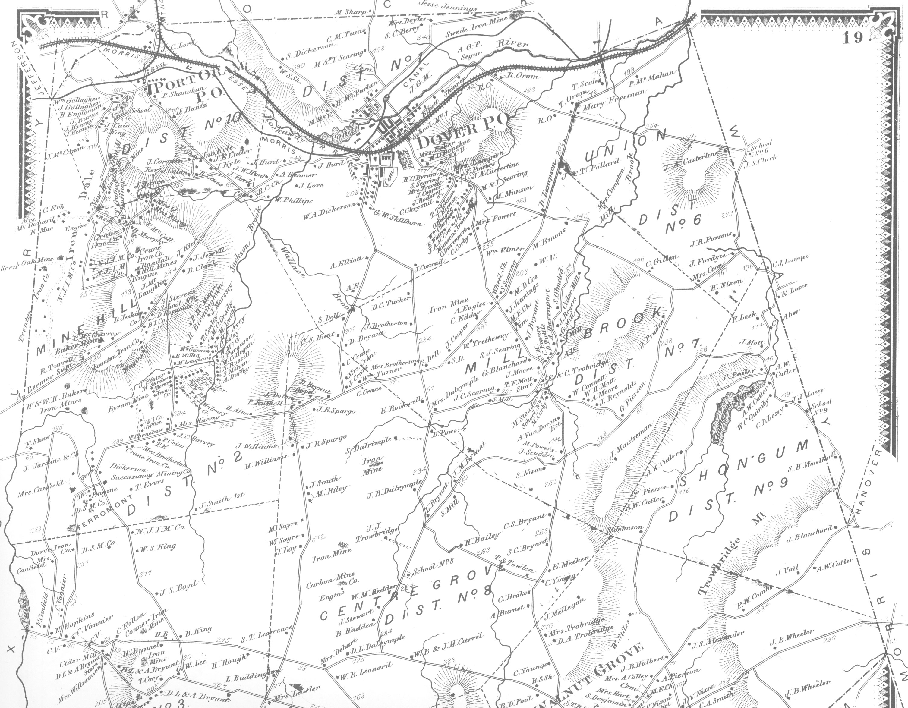
Randolf Township:
|
|
Randolph Township – 1868
|
|
Randolph Township: Randolph 1-
1868
|
|
Randolph Township – 1886
|
Randolf Township - 1887
|
| Mine Hill |
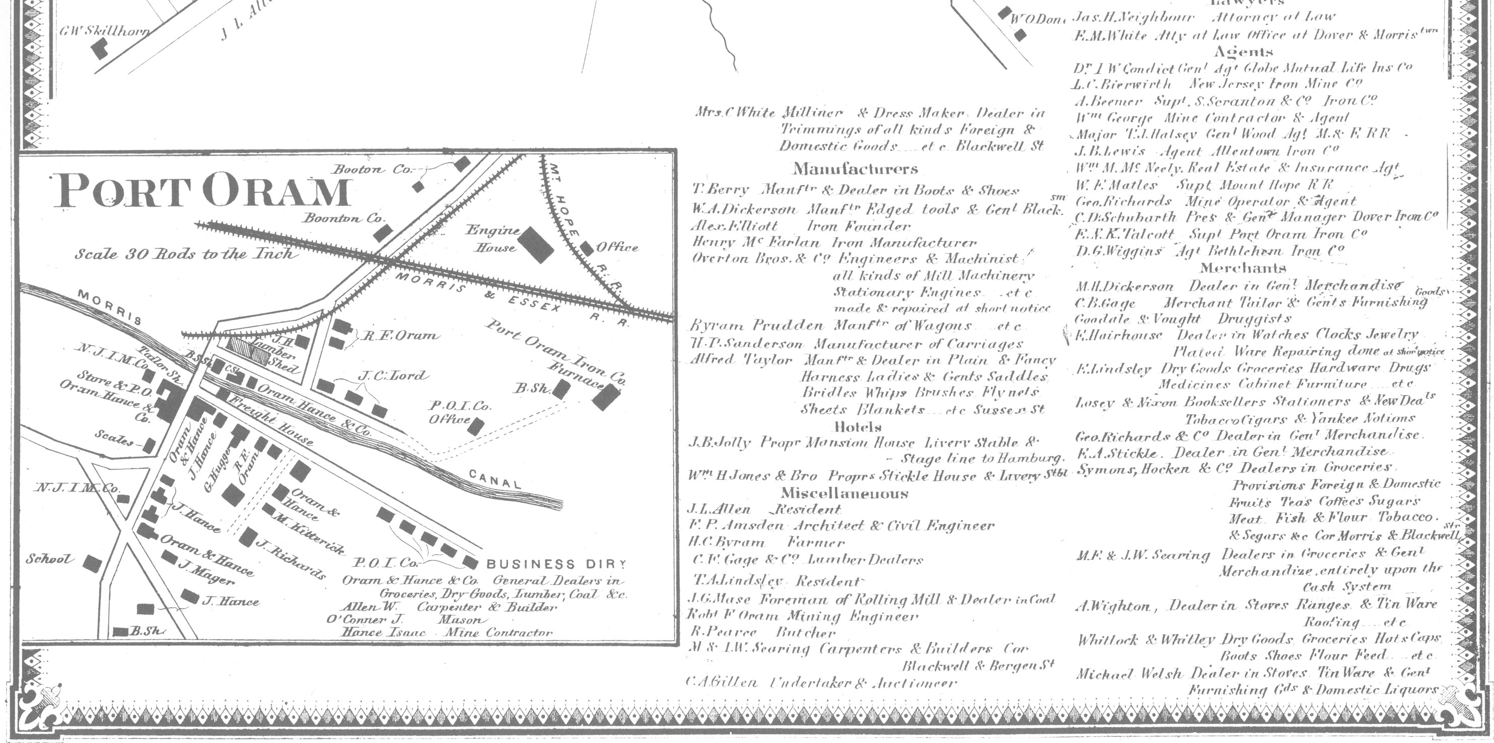
| Port Oram |
|
Randolph Township: Dover &
Port Oram – 1868
|
|
Randolph Township: Port Oram –
1868
|
|
Randolph Township: Port Oram –
1886
|
| Dover |
|
Randolph Township: Dover 2 – 1868
|
|
Randolph Township: Dover – 1884
A view of the canal is on Image 2.
|
|
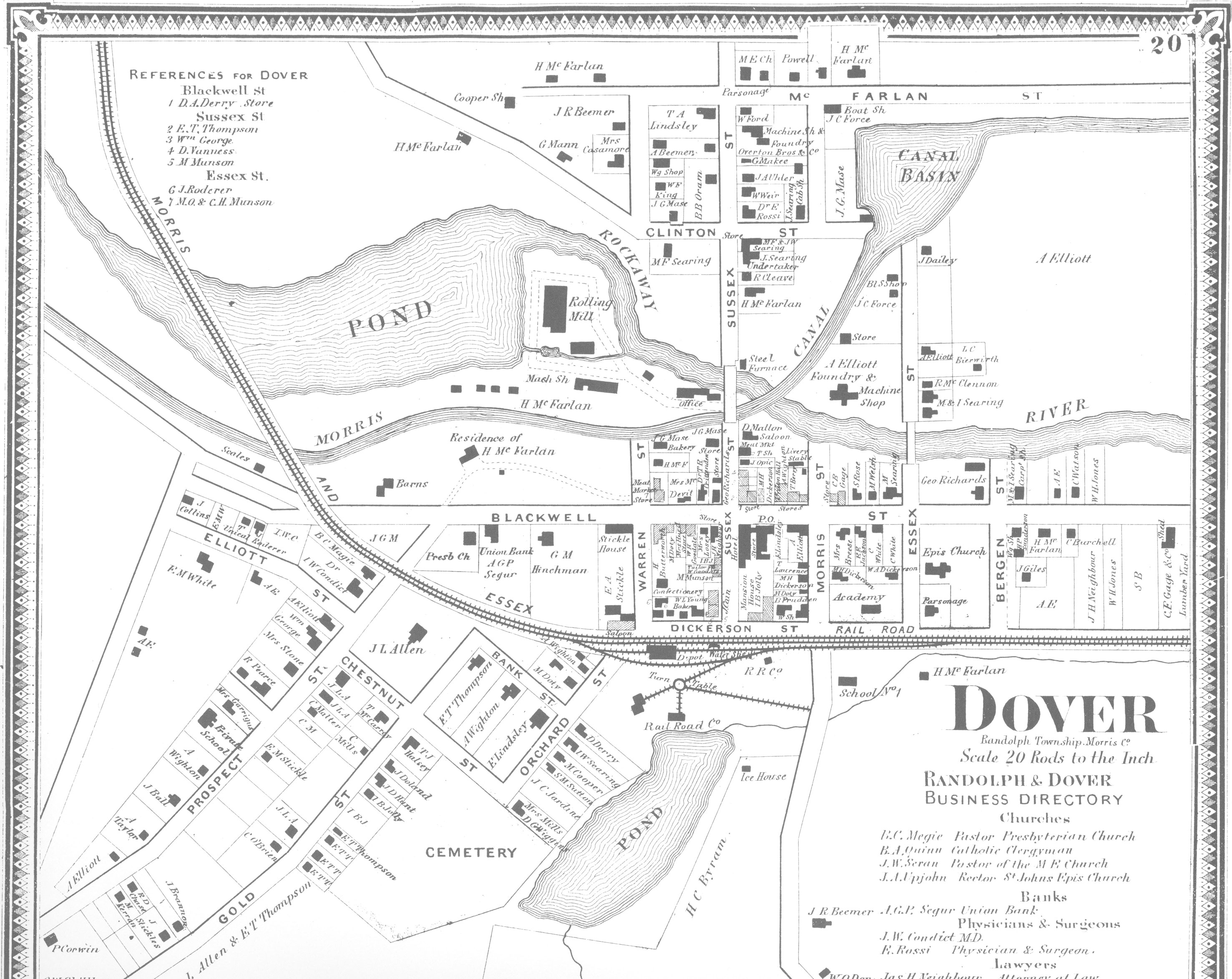
Randolph Township: Dover – 1886
Views of the canal are on all five
Images.
|
|
Randolph Township: Dover
Borough – 1887
|
|
Randolph Township: Dover –
1887
|
|
Randolph Township: Dover –
1890
Views of the canal are on Images 1,
2, 3, 4 and 7.
|
|
Randolph Township, Dover –
1896
Views of the canal are on Images 1,
4, 5, 6, 9 and 12.
|
|
Randolph Township, Dover –
1901
Views of the canal are on Images 1,
4, 5, 9, 10, 14 and 17.
|
|
Randolph Township, Dover –
1909
Views of the canal are on Images 1,
4, 5, 9, 10, 14 and 17.
|
|
Randolph Township, Dover –
1916
Views of the canal are on Images 1,
2, 3, 8, 9, 11, 12, 13, 15, 16, 21, 25 and 26.
|
Rockaway Township:
|
|
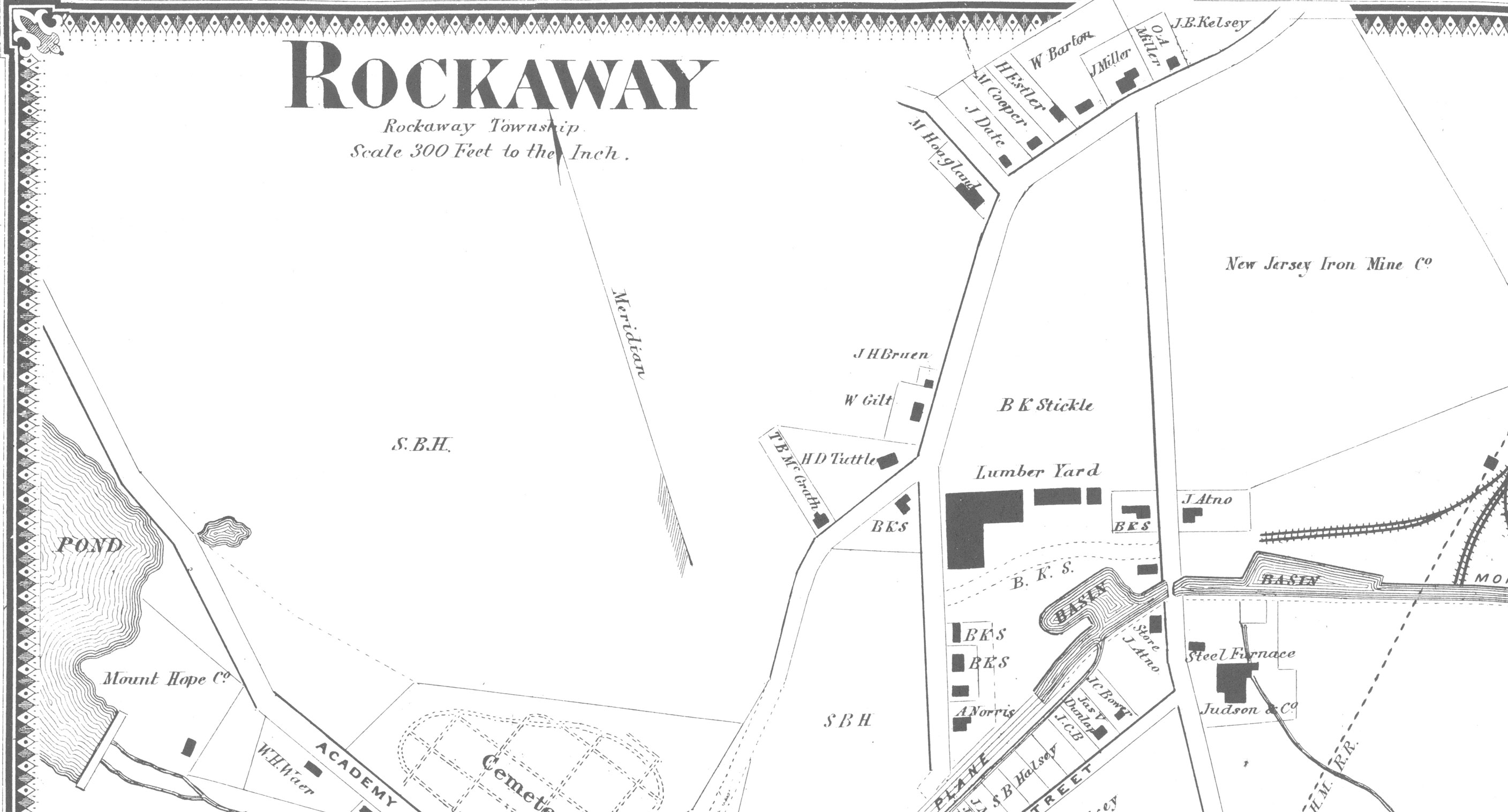
Rockaway Township I – 1868
|
|
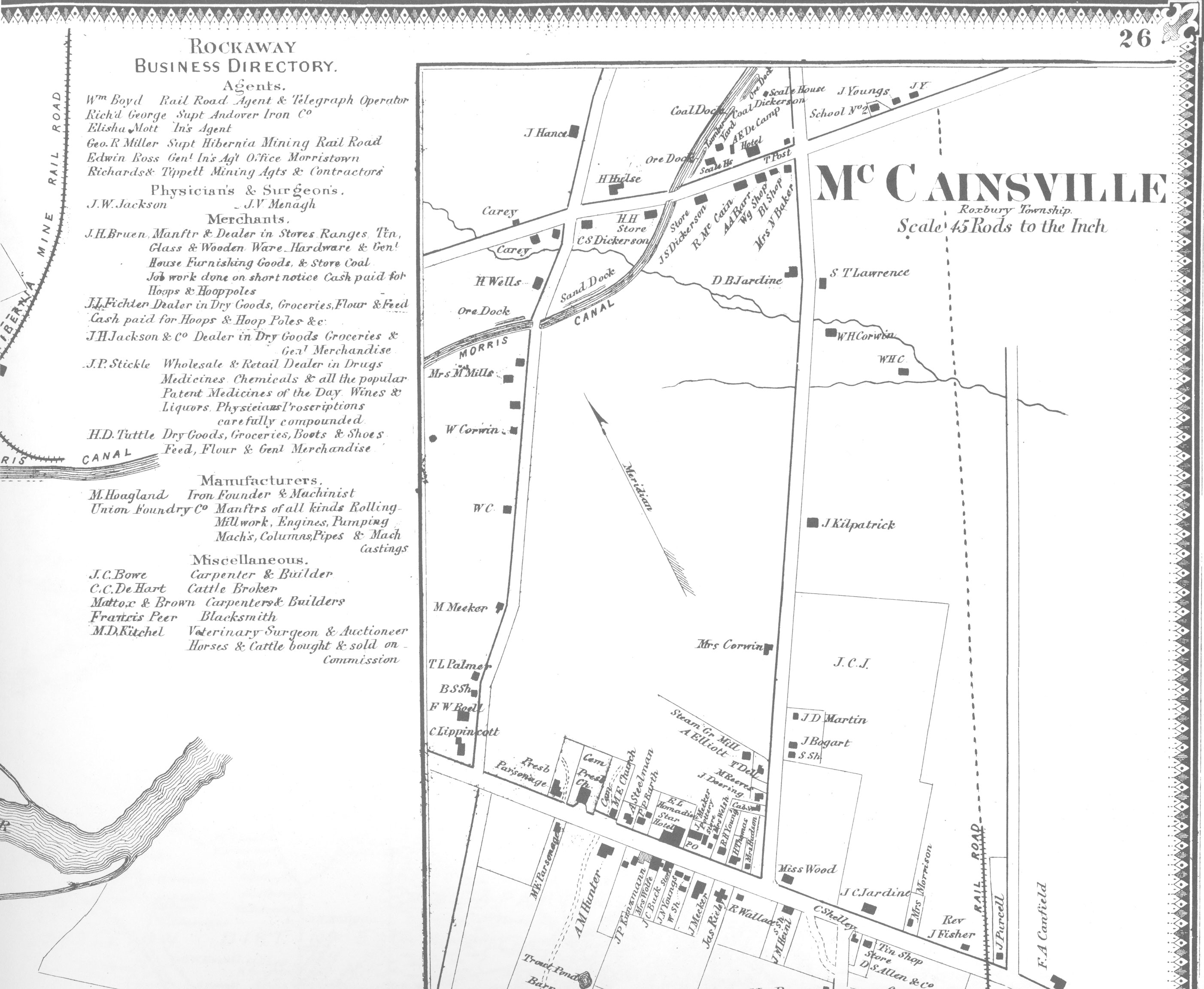
Rockaway Township: Rockaway 2,
McCainsville & Succasunny – 1868
|
| Rockaway |
|
Rockaway Township: Rockaway 1
– 1868
|
|
Rockaway Township: Rockaway 2
– 1868
|
|
Rockaway Township: Rockaway 3
– 1868
|
|
Rockaway Township: Rockaway 7
– 1868
|
|
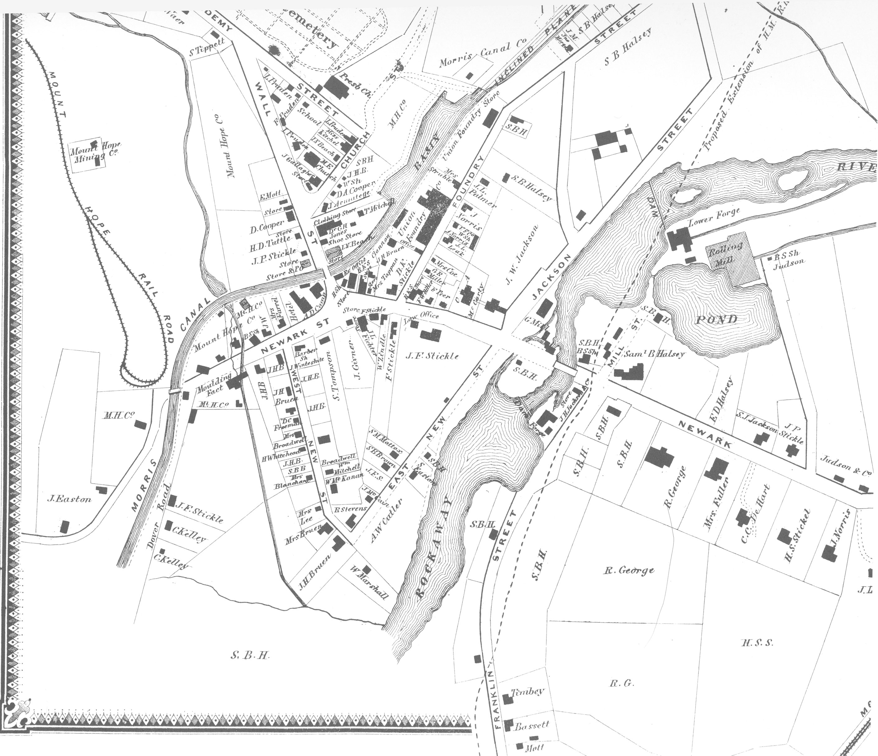
Rockaway Township: Rockaway –
1886
|
|
Rockaway, Rockaway Plan – 1887
|
|
Rockaway Township: Rockaway –
1898
Views of the canal are on Images 2
and 3.
|
| Rockaway Borough |
|
Rockaway, New Jersey bird’s
eye view – 1902
|
|
Rockaway Township: Rockaway – 1904
Views of the canal are on Images 1
and 2.
|
|
Rockaway Township: Rockaway –
1911
Views of the canal are on Images 1
and 2.
|
| McCainsville |
|
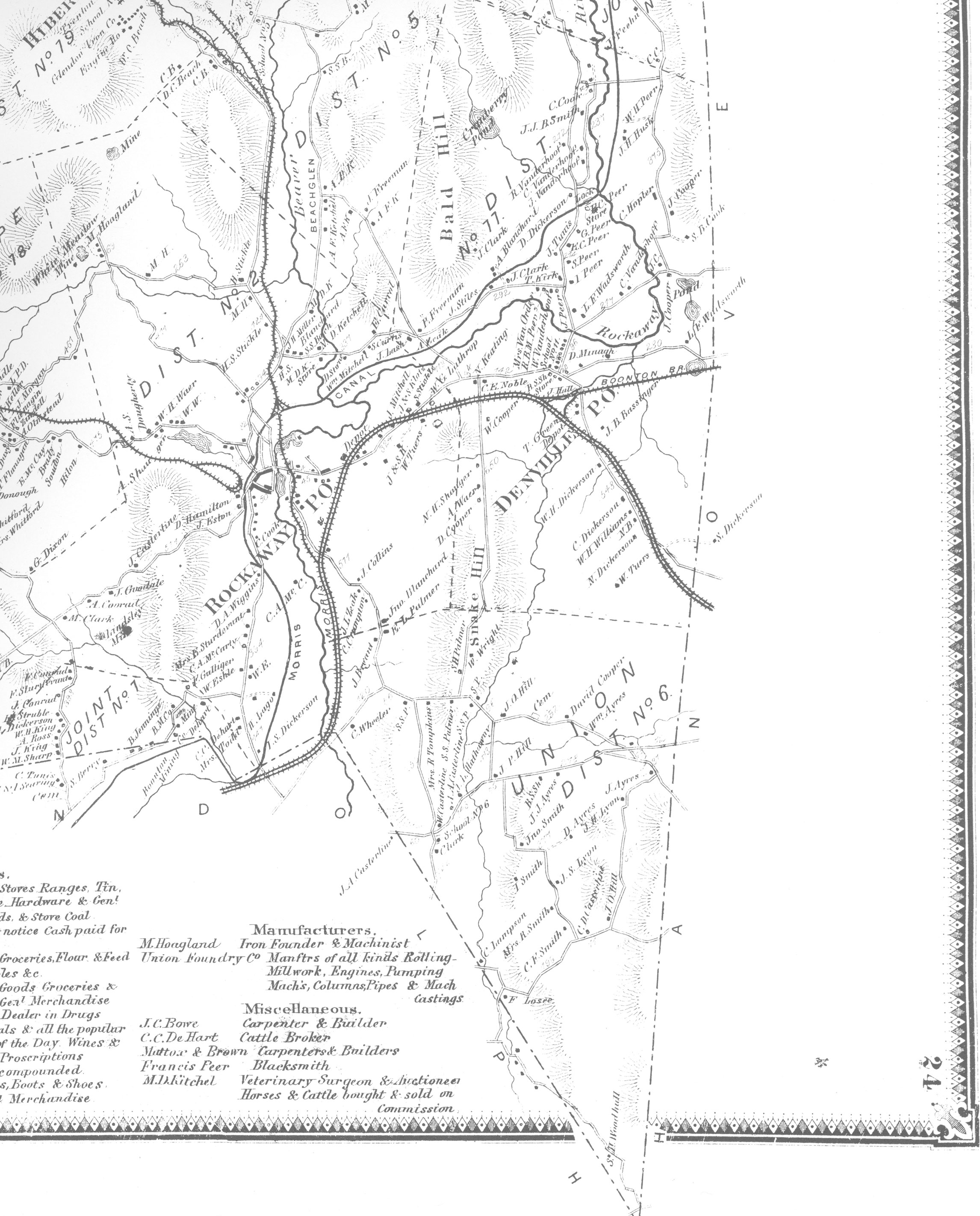
Rockaway Township, Hibernia
P.O., Denville P.O. – 1887
|
Powerville
|
| Boonton
Township: |
|
Boonton Township: Town of Boonton-Montville
1 – 1868
|
|
Boonton 1, Montville Townships
– 1868
|
|
Boonton & Montville
Townships – 1887
|
| Boonton |
|
Boonton: Sanborn Fire
Insurance maps
A collection of maps ranging from
1886 to 1916.
|
|
Boonton 1 – 1887
|
|
Boonton 2 – 1887
|
| Montville Township: |
| Montville |
| White Hall |
Pequannock Township:
|
|
Pequannock – 1868
|
|
Pequannock Township – 1887
|
|
|
PASSAIC
COUNTY
|
|
Bergen and Passaic Counties –
1861
|
|
Passaic County – 1877
|
| Little Falls Township (split off from Acquackanonck
Township between 1861 & 11877): |
| Pompton (Pompton Feeder) |
| Wayne Township (Pompton Feeder) |
|
Little Falls Township – 1877
|
| Little Falls |
|
Little Falls Village – 1877
|
|
Little Falls, New Jersey –
1915
Views of the canal are on Images 1, 3
and 4.
|
Totowa
 |
| Woodland
Park (formerly West Paterson) |
| Paterson |
|
Passaic County, Paterson –
1871
|
|
Passaic County, Paterson City,
Wards 2, 7 and 8 – 1877
|
|
Passaic County, Paterson City,
Wards 5 and 8 – 1877
|
|
Paterson, N.J. – 1893
|
|
Paterson, N.J. – 1895
|
|
Paterson, N.J. – 1908
|
|
Paterson, New Jersey – Vol. 3
– 1915
Views of the canal are on Images 1,
5, 6, 7, 12, 13, 16, 19, 21, 26 and 27.
|
|
Paterson, N.J. – 1919
|
| Acquackanonck
Township:
|
| Clifton
|
|
Acquackanonck Township,
Centreville Village, West Clifton – 1877
|
ESSEX COUNTY
|
|
Essex County – 1850
|
|
Essex County – 1874
|
|
Holbrook's map of the city of
Newark, New Jersey – 1875
|
|
Essex County – 1877
|
|
Essex County – 1881
Images of the canal are on Pages 010,
011,018, 139, 054, 055, 066, 067, 074, 145, 148, 149 and
153.
|
|
Index Map of Essex County, New
Jersey – 1881
|
|
Colton's road map of Union and
Essex counties, New Jersey – 1890
|
|
Driving and bicycle map of
Essex County, New Jersey – 1890
|
|
Baldwin's map of Essex County,
New Jersey – 1893
|
|
Essex County 1906 Vol 3
Views of the canal are found on Plates
11,
15, 16, 17, 18, Newark - Ward Map and Plate 001.
|
|
Essex County: Bloomfield, New
Jersey – 1885
A view of the canal is found on Image
1.
|
|
Essex County: Bloomfield, New
Jersey – 1907
Views of the canal are on Images 1-4,
6, 7, 9-11, 19, 21, 50, 52, 53, 57 & 58.
|
| Fairview |
|
Essex County: Nutley, New
Jersey – 1906
A view of the canal is found on Image
2.
|
|
Essex County, Newark maps –
New York Public Library
A collection of maps of the city,
some of which show the canal.
|
|
Newark and East Newark, N.J. –
1836
|
|
Essex County, Newark – 1859?
|
|
Essex County, Newark – 1875
|
|
Index of the City of Newark –
1881
|
|
Newark, N.J. bird’s-eye view -
1895
|
|
Newark, N.J. bird’s-eye view –
1916
|
|
Old Newark Insurance-type Maps
Links to maps showing the canal
route, for the years 1868 through 1931. Review
first of the index map for each link will identify which
detailed plates show the canal route. From
the individual plate maps details of the canal (locks,
bridges, inclines, etc.) and adjacent businesses can be
located.
|
|
Old Newark Maps
Links to street maps of the city,
from 1836 to 1915.
|
| Hudson
County |
|
Topographical map of Jersey
City, Hoboken, and the adjacent country – 1841
|
|
Essex, Union and Hudson
Counties – 1873
|
|
Hudson County: Index Map and
County Outline – 1873
|
|
Sanborn Fire Insurance Map
from Hudson Co., Hudson County, New Jersey, Vol 1 –
1885
Views of the canal are on Images 1,
3, 5, 12, 13, 20, 21, 22, 33, 40, 41, 48, 49, 50, 51
Additional
similar Hudson County maps for the years 1887, 1891,
1896 & 1906 are in the Library of Congress Sanborn
map collection.
|
|
City & county map of
New-York : Brooklyn, Williamsburgh, Jersey City &
the adjacent waters – 1857
|
| Kearney |
|
Jersey City - District 6 -
Formerly Greenville – 1873
|
|
Plate S - Jersey City – 1873
|
|
Plate O - Jersey City – 1873
|
|
Plate D - Jersey City – 1873
|
|
Plate C - Jersey City – 1873
|
|
Plate A - Jersey City – 1873
|
|
New York City: Brooklyn,
Jersey City, Hoboken, etc. – 1879
|
|
Hudson County 1908 Vol 1
Comprising Jersey City
Views
of the canal are on the Index map and Plates 001, 002,
005, 017, 019, 022, 023, 024, 027, 028, 029
|
|
Bayonne City – 1873
|
|
